|
Destination Highways
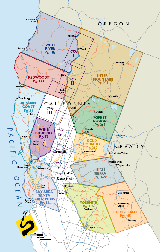
NorCal breaks the state into
the 11 regions shown below as covered by the book. Six pages of Overall maps
blow this area up to a much larger scale. Each region has between four and
nine DHs. There are 11 Regional maps at the beginning of each region that
show you all the DHs (Destination Highways) and TEs (Twisted
Edges) within each region on one map, for context. Then, the Local maps
(sometimes as many as three per DH) for each of the 74 DHs
(and their attendant 260 TE side roads) show all the important
features and services (gas, bike shops, food & drink, accommodations
& camping, police stations) along the way. In addition there are six
maps (not outlined below) as a subset of the Bay Area - Santa Cruz Mtns
Region showing the 29 Bay Area TEs and six more maps showing the 23
Central Valley (CVA) TEs.
Close window
Copyright Twisted Edge 2007 ©
|